Mormon Peak - California

Coordinates: 36.0255181, -117.044716
Address: 130 Homewood Canyon Road
Paths To:
View On: Long Lines Map | Google Maps | Bing Maps

View Random Site

Site Notes

Add site note

Added site picture   Collapse/Expand

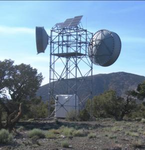
Dual pic is from 2022 NPS comment request for AT&T to increase the shelter size, solar panel size, and increase the bandwidth of the site.

Note   Collapse/Expand

This site was never part of the Long Lines network but currently supports a microwave path from Slate to Furnace Creek, providing internet access to Death Valley National Park

Note   Collapse/Expand

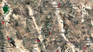
Active Pacific Bell Routes >> WHE225, Path 3, Segment 1: MORMON PK - SLATE 1 << WHE225, Path 4, Segment 1: MORMON PK - FURNACE CK 2

Site Documents

Site Pictures

Add site Pictures

This event has 0 comments.

Please log in to leave a comment.

All information is provided for free to the public. Pictures and Documents are provided by supporters of the website and for that I am very gateful.
For any questions or comments please email [email protected].