SITE HISTORY (MARK FOSTER'S SITE) Collapse/Expand
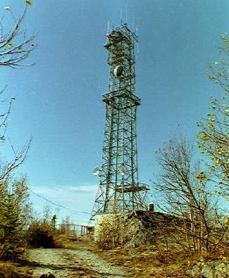
The Black Mountain site today. Note that tower construction has
changed from 3 legs to four legs. Platforms for the since removed
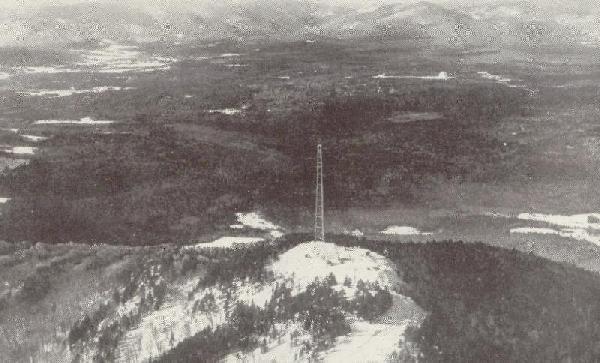
KS horns can still be seen at the top and lower level. In the foreground is the Black Mountain radio relay site. In the upper right of the photograph is the
Andover Earth Station. Note that the earth station is on the floor of a large bowl surrounded by
mountains. Andover was chosen over sites in Pennsylvania, W. Virginia, and the Del Marva area of Delaware
mainly due to the lack of interference from existing and potential TD-2 and TH microwave systems.
The "first hop" from the earth station to the Black Mountain site was TJ (11 KMC) to avoid interference
with the earth stations 6 KMC TX and 4 KMC RX. The Black Mountain site then shot to West Paris, ME then
Cornish, ME and then to Portland, ME.
ARCHIVED FROM MARK FOSTER'S SITE