Vinton - Iowa
Coordinates: 42.18494034, -91.97685242
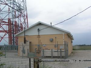
Address: 10 S. Canal St. FL 1 (2685 - 58th Street) Vinton 52349
Paths To: RAYMOND IA Manchester Cedar Rapids
View On: Long Lines Map | Google Maps | Bing Maps
View Random Site

If you wish to enter the Authors Name please enter it BEFORE you start uploading.
Address: 10 S. Canal St. FL 1 (2685 - 58th Street) Vinton 52349
Paths To: RAYMOND IA Manchester Cedar Rapids
View On: Long Lines Map | Google Maps | Bing Maps
View Random Site
Site Notes
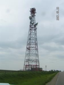
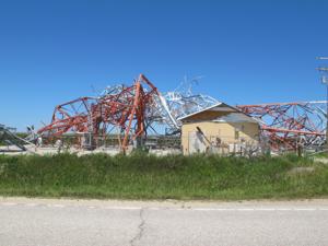
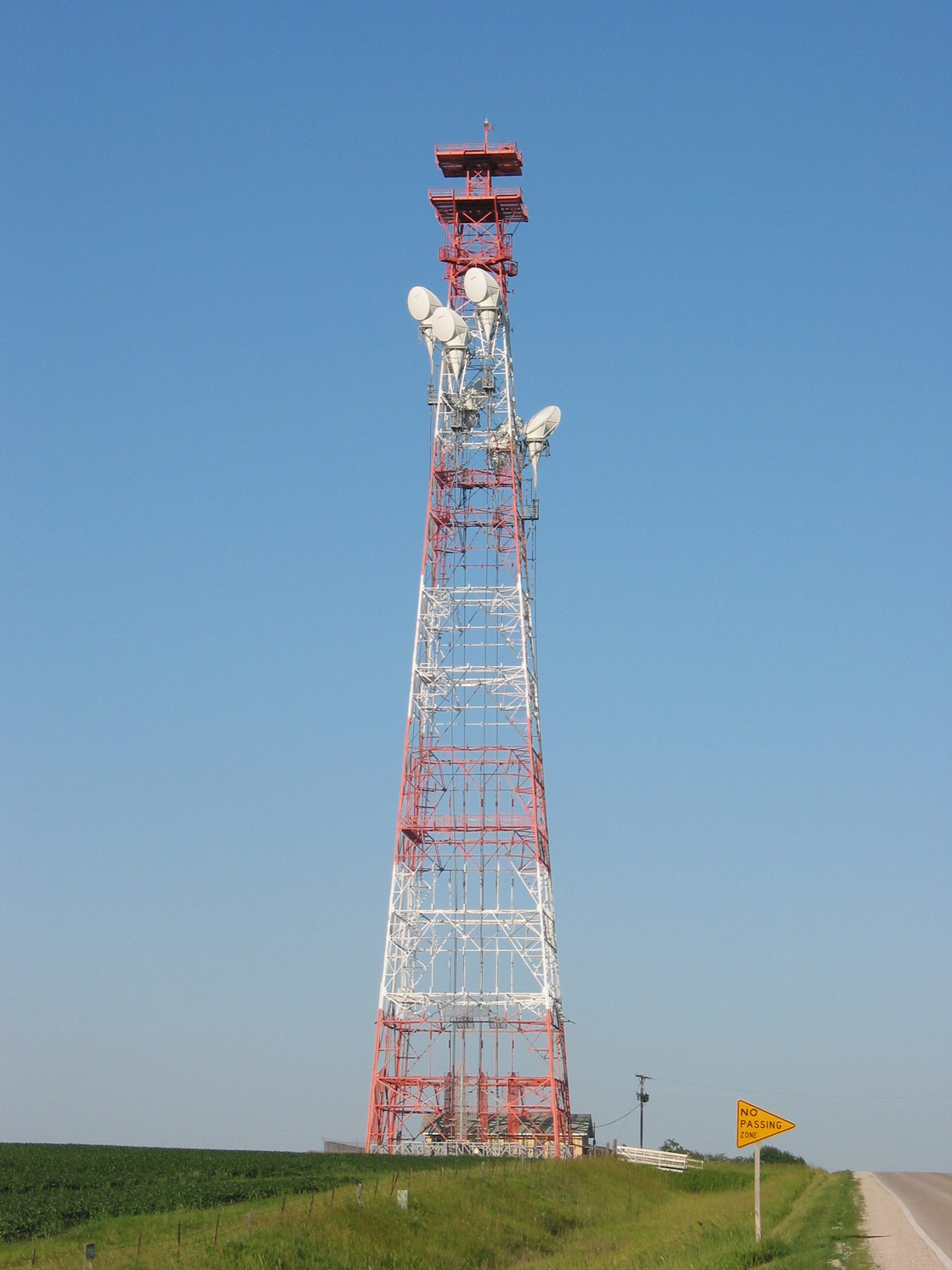
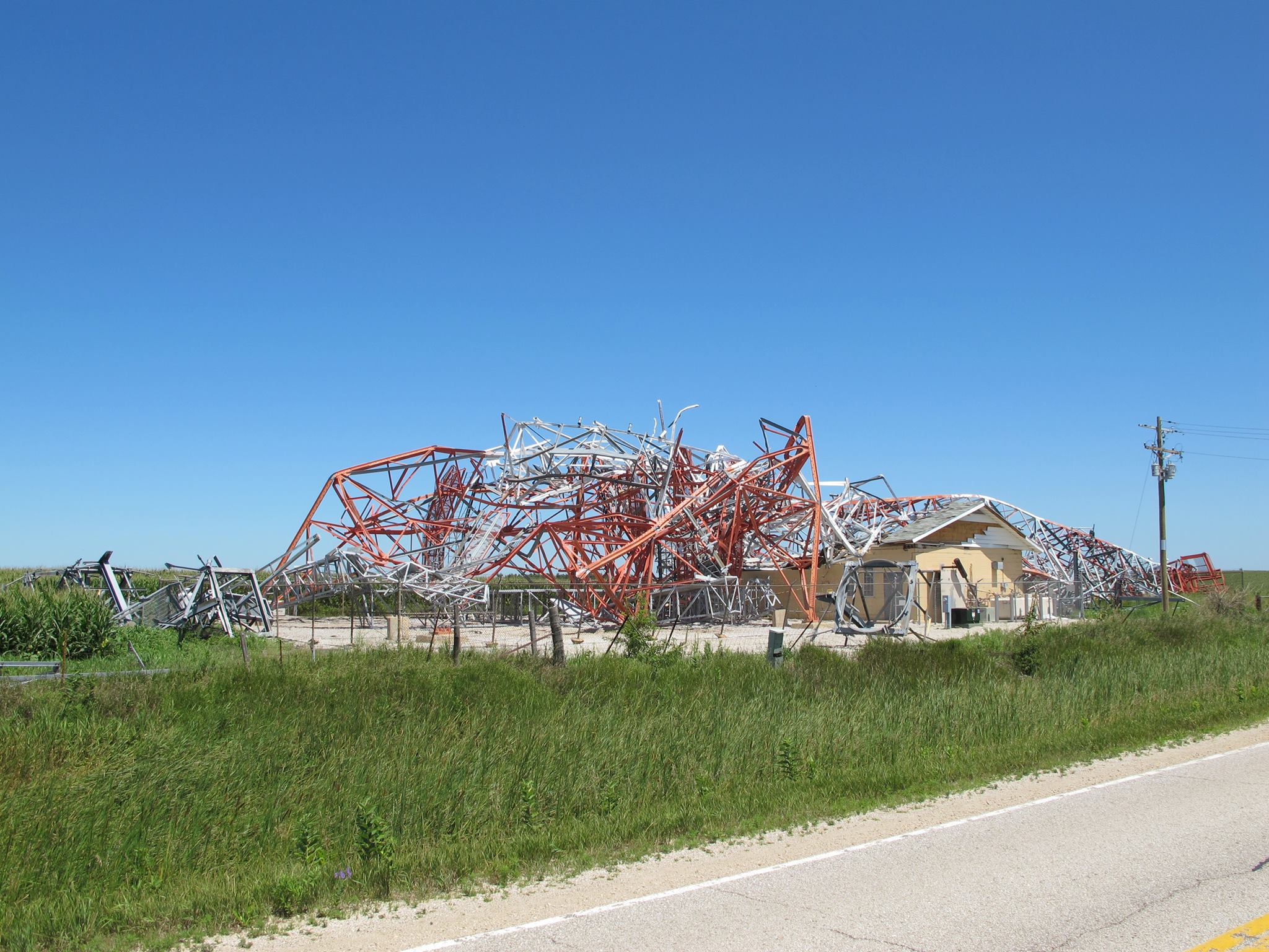
Add site noteTower gone Collapse/Expand
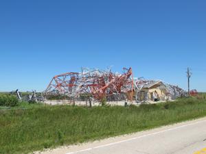
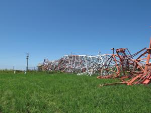
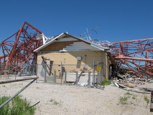
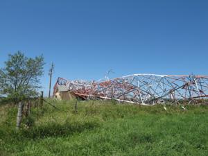
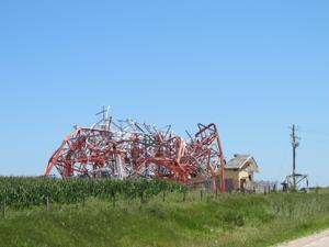
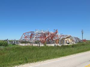
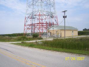
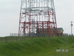
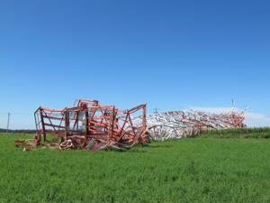
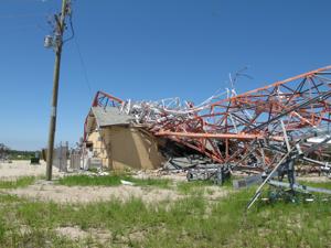
Tower taken down by 130mph winds in 2011 also destroying equipment building.
AT&T Tower gone Collapse/Expand
Tower taken down by 130mph winds in 2011 also destroying equipment building. Replaced with a much smaller tower by American Tower. No more buildings on site.
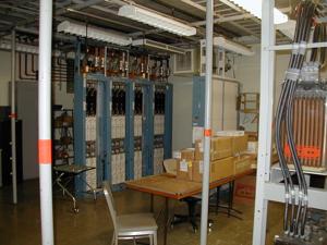
Site Documents
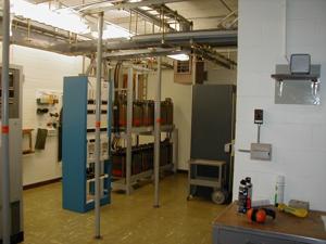
Site Pictures
Add site Pictures


Upload Site Images
All information is provided for free to the public. Pictures and Documents are provided by supporters of the website and for that I am very gateful.
For any questions or comments please email [email protected].
For any questions or comments please email [email protected].